 A little history of the Mojave Desert and the Mojave Trail –
20,000 years ago, this was a wetter area and the 147 miles of the Mojave River “wandered around the desert like a prospector.” The River filled up ancient Lake Manix and, in extra wet periods, spilled out into a grassy valley where Baker is now (Lake Mojave).
Between 15,500 and 18,000 years ago, the Manix Fault at Afton Canyon slipped and opened a rift. Lake Manix exploded out into the valley and Lake Mojave (the area around Baker). It was such a catastrophic event that it filled up Lake Mojave and flowed into a series of ancient lakes along the route to what is now Death Valley. The whole lake system was filled with a variety of plants and animals – and, eventually, man. There were pines, junipers, oaks, grapevines, ferns, wild flowers, and grassy valleys. A few of the animals were storks, cranes, flamingos, freshwater clams, eagles, owls, bear, ground sloths (4-6′ tall), camels, llamas_ ancient horses, mammoth, large bison, dire wolf, and saber-toothed cats. As the climate changed, more animals became extinct, and it evolved into the present desert landscape. Keep all these things in mind as you ride and imagine what once was.
In 1776, Father Garces followed the Indian route from the Colorado River to the Pacific Ocean. This route was shown him by the local Indians who used the trail to trade for sea shells on the coast of California.
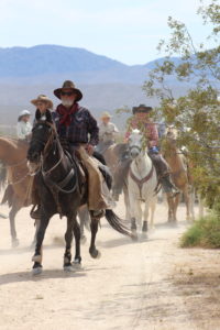
Following Garces were the pioneers and soldiers. While only one route is designated the “Mojave Road” on our present-day maps, there were many routes, depending on rainfall and conditions. The military, Jedediah Smith, Kit Carson, and many other explorers used this route. From these early travels, the trail was established as a major supply route, administered first by Mexico and then by the U.S. Some of the personal accounts of treks along the Mojave River Trail are noted in the book by Clifford J. Walker, Back Door to California: The Story of the Mojave River Trail.You can purchase the book from the sources listed in the front.
In the distance, across the dry lake, you can see the springs at Zzyzx. Zzyzx was the site of an old wagon stop, then Dr. Springer sold “blessed” mud. It is now a nature study conservancy operated by the Mojave National Preserve and the California State University system. Along our route we will ride by many petroglyph sites. No one really knows what all the symbols mean but they were created by an ancient people in an attempt to communicate . . . what? Most are found by water sources. Some say they indicate religious sites, some say gold sites. Who knows!
The whole desert was used by ranchers for over 100 years. They have developed the water sources that have benefited both their cattle and the local wildlife. Most of the ranches have been purchased by the Park Service and the cattle water tanks have been shut down. This is the end of an era and we will miss seeing the cattle and the improvements made by the cattlemen and woman and the hardy pioneers that traveled the Mojave Trail.
